Friday, April 19, 2024 | Today's Newsletter | Login
What is going to heat up our world this summer
A UBC expert says an El Niño this year could be warmer than usual and have harsh consequences for world farmers in Asia and North America.
Climatologists are predicting an El Niño pattern will develop at some point this summer, bringing with it the potential for major weather events.
Caused by periodic warming of part of the Pacific Ocean, El Niños occur every two to seven years and are associated with changes in weather around the world.
El Nino events usually occur about every four years. During non-El Nino years, warm water pools up in the western Pacific—near Australia and Asia—while cooler waters linger along the coast of the Americas. In an El Nino event, shifting wind patterns and wave activity push that warm pool eastward toward South America and California, leaving cool water near Asia. This typically brings drought to the western Pacific and heavy rains and hotter temperatures to the east. The strength of the winds and waves can determine how powerful the El Nino's effects might be.
El Nino became a household name in late 1997 and early 1998 when an especially strong event caused widespread damage. Australia suffered its worst drought in decades. Cliffside homes in California washed into the ocean and torrential rains caused landslides and severe flooding in Colombia and Peru. The event was blamed for about 23,000 deaths worldwide and more than $33 billion in damages.
The most recent El Nino was in late 2009 to early 2010 and, while it did boost temperatures and disrupt climate patterns, it was a relatively moderate event.
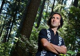
Simon Donner, a climate scientist in UBC’s Department of Geography, explains the impact El Niño could have on global weather patterns.
When should we start to see El Niño develop and how will the average person notice it?
El Niño typically develops during our fall and reaches peak strength during our winter and early spring. Scientists are watching conditions in the Pacific Ocean to check early suspicions that a new event is on the way.
El Niño itself begins far away in the equatorial Pacific. A reversal of winds and currents brings unusually warm waters to an area between the coast of South America and the International Date Line. This is like dropping a huge rock in a stream. The warm waters release so much energy into the atmosphere that the normal flow of air is diverted, affecting weather all over the planet.
If a strong event develops, people across Western and Central Canada should see an unusually mild, dry winter and spring. On the other hand, people across parts of the southern U.S. should see unusually wet conditions.
Will climate change play a role in strengthening this El Niño?
Climate change affects everything that happens in the atmosphere and the ocean. The jury is still out on exactly how climate change affects the development of El Niño events.
One thing is certain: as the planet has warmed, El Niño events have also warmed. Our research shows that, all else being equal, an El Niño event today is warmer around the world than an identical event 100 years ago.
How could El Niño affect global agriculture and fishing?
El Niño is no joke. Regional heat and drought brought by a classic “Eastern Pacific” El Niño can be devastating to farmers in southern Africa, India, Southeast Asia, Australia, the Pacific Islands, and even the Canadian prairies. The warm El Niño waters also choke off the supply of nutrients to the great fisheries off the coast of South America. We’d all see the effect in global food prices.
One silver lining may be California. El Niño rains could offer a respite from the intense three-year drought that has crippled production in the Central Valley.
Will a potential El Niño affect global temperatures in the coming months?
In general, El Niño events are expected to cause a spike in global average temperature. But not all El Niño events are created equal. Research led by my former student Sandra Banholzer shows that only the classic events with the ocean warming in the eastern Pacific–as last happened in 1997/1998–definitely lead to an increase in global average temperature.
Since then, El Niño events have been more of the “Central Pacific” variety, which are not necessarily warm globally. The supposed “pause” in global warming over the past 15 years is nothing of the sort. The planet has been warming, but thanks to these naturally variable conditions in the Pacific, more heat than usual has gone into the ocean.
The overall global warming trend is so strong that even a weaker El Niño is enough to break global temperature records. This past May was already the warmest May in recorded history. If the overall Pacific pattern flips in the coming months, bringing a strong classic El Niño, we’re likely to shatter global temperature records.
Leave a comment